The Canadian Watershed Information Network (CanWIN) is a collaborative, distributed platform focused on providing access to environmental data related to watersheds in Canada. We address critical water issues such as water quality, water scarcity, and ecosystem health, by fostering interdisciplinary research and promoting innovation through access to trans-disciplinary data.
Media
Our Case Study From Data to Knowledge
Partners
CanWIN partners with freshwater and arctic data centers across Canada and globally. It is a founding member of the Canadian Consortium for Arctic Data Interoperability (CCADI) a pan-Canadian collaboration of arctic data centers and domain experts such as Amundsen Science who are developing an integrated Canadian arctic research data infrastructure system (ARDI). CanWIN partnerships with freshwater research and data centers include the Lake Winnipeg Research Consortium and the International Institute for Sustainable development – Experimental Lakes Area (IISD-ELA) where we collaborate on standardizing and sharing freshwater research and community collected datasets.
Data Management
CanWIN is mindful of the CARE, FAIR and OCAP principles for data sharing and supports the sharing of open data in a way that considers both people and purpose in open data advocacy.
Data Architecture
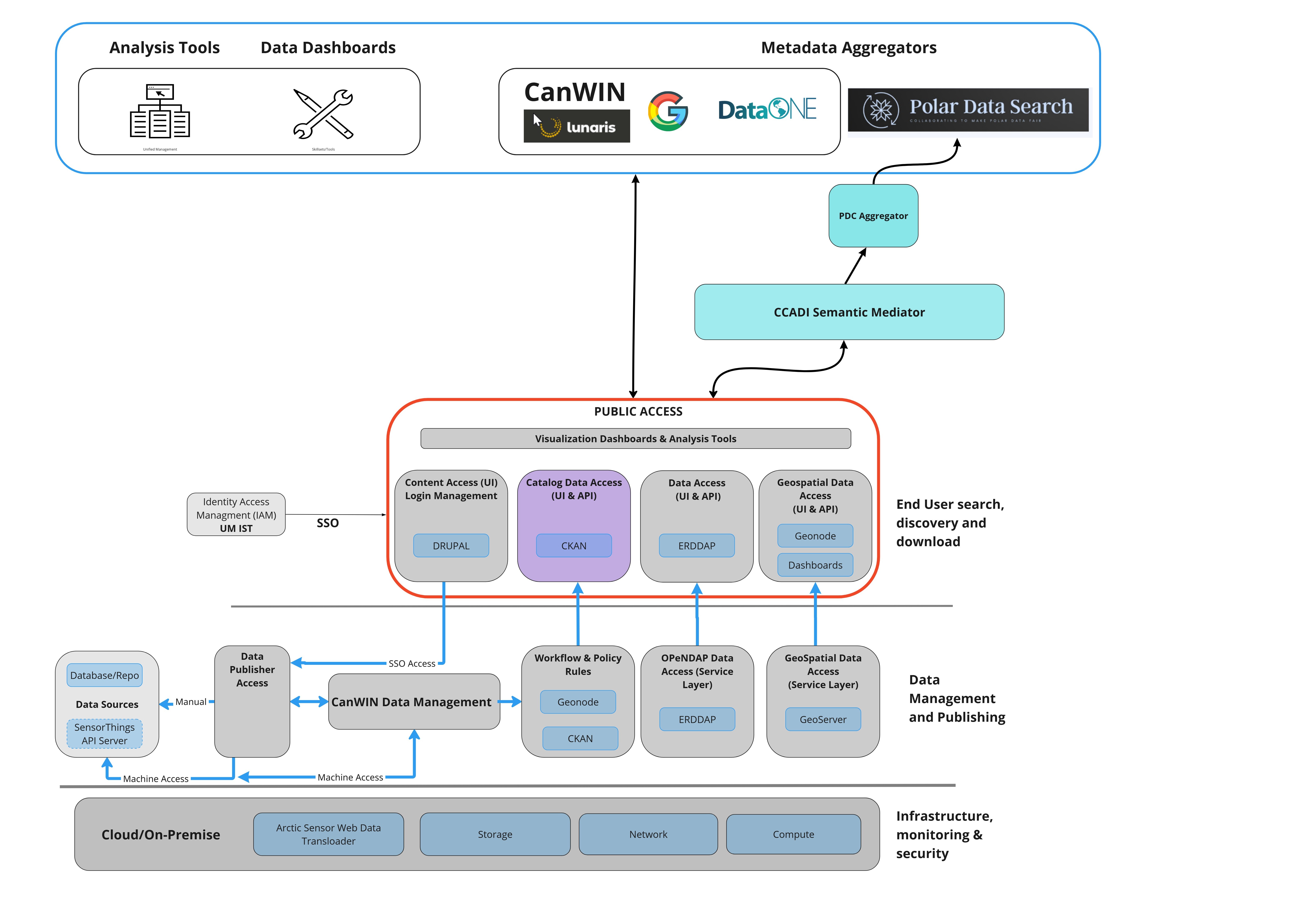
CanWIN was created as a distributed data system. This allows us to easily store and share data in multiple formats from many disciplines. The CanWIN datahub Home page acts as the main entry point from which users can search for data held on any of our servers. Users are able to download data located on any of the servers from the Dataset page - in addition, they are able to access additional features provided by our other servers (e.g. map data) from the Quick links bar on the Home page. The diagram below shows the key components that make up the CanWIN Ecosystem. They include the main CanWIN platform which uses CKAN, a geoportal for map viewing and creation, and an ERDDAP server for advanced data manipulation.
